Venture Blog 4: Visiting Prince Of Wales Island

Crossing Chatham Straight to Prince of Wales Island

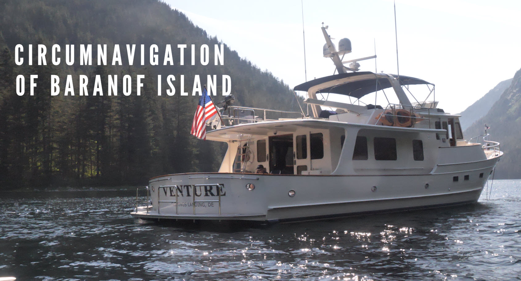
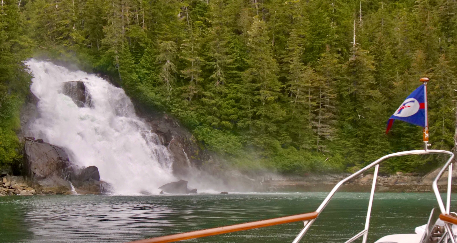
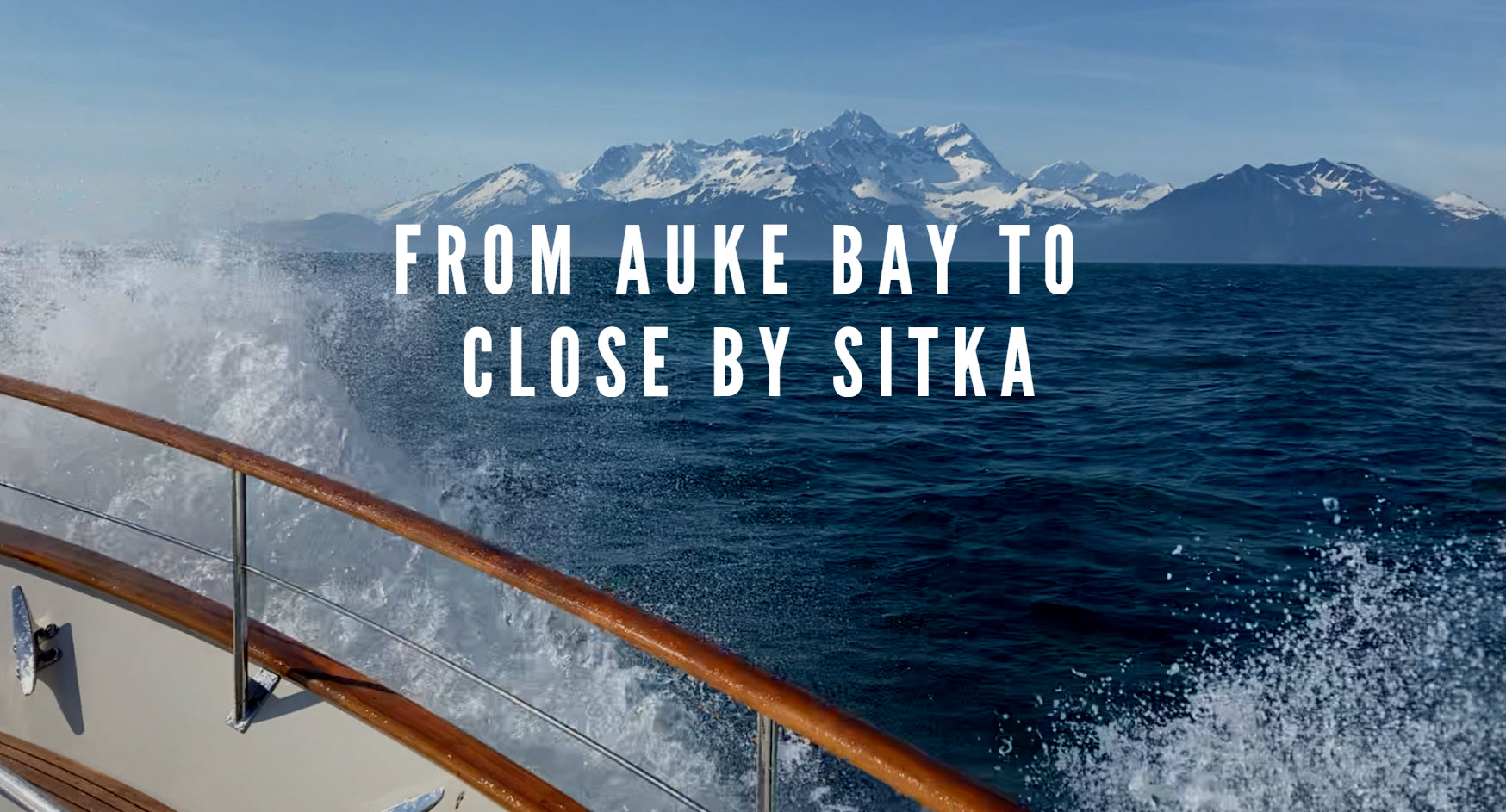
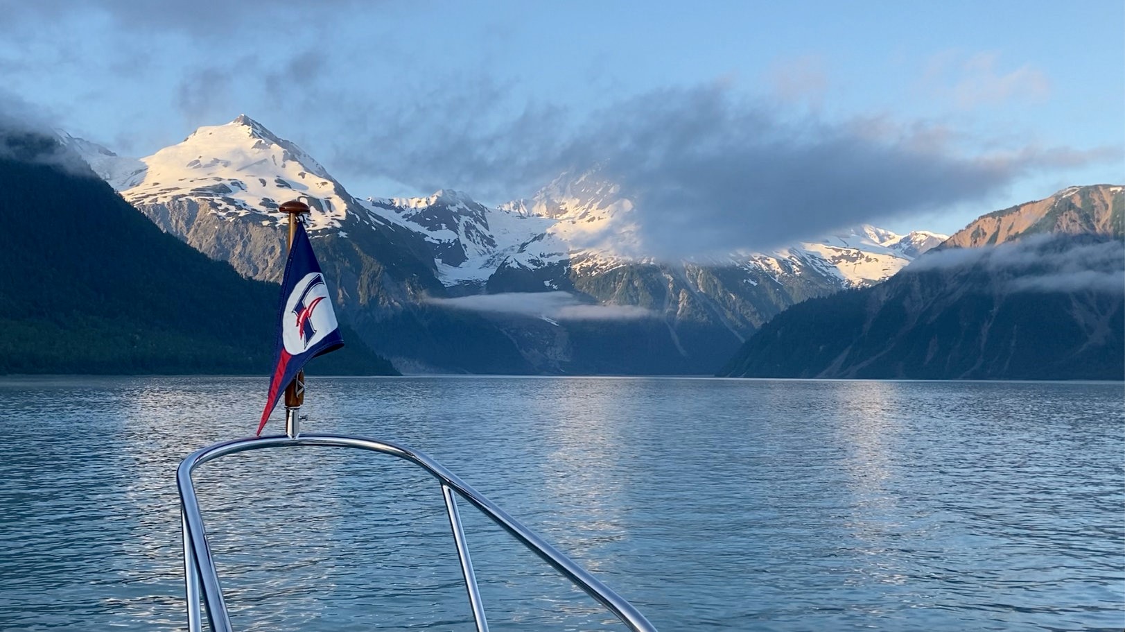
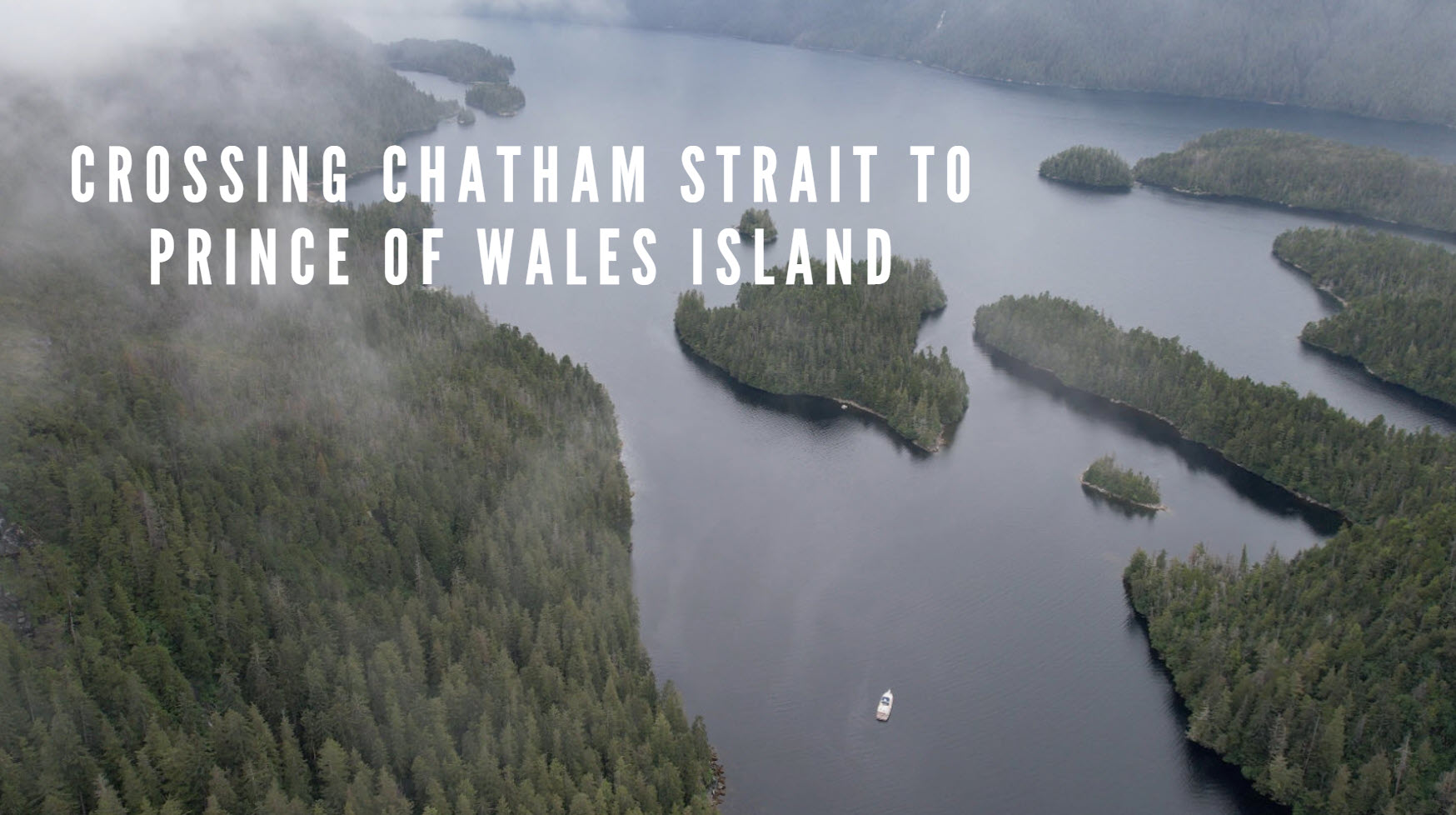
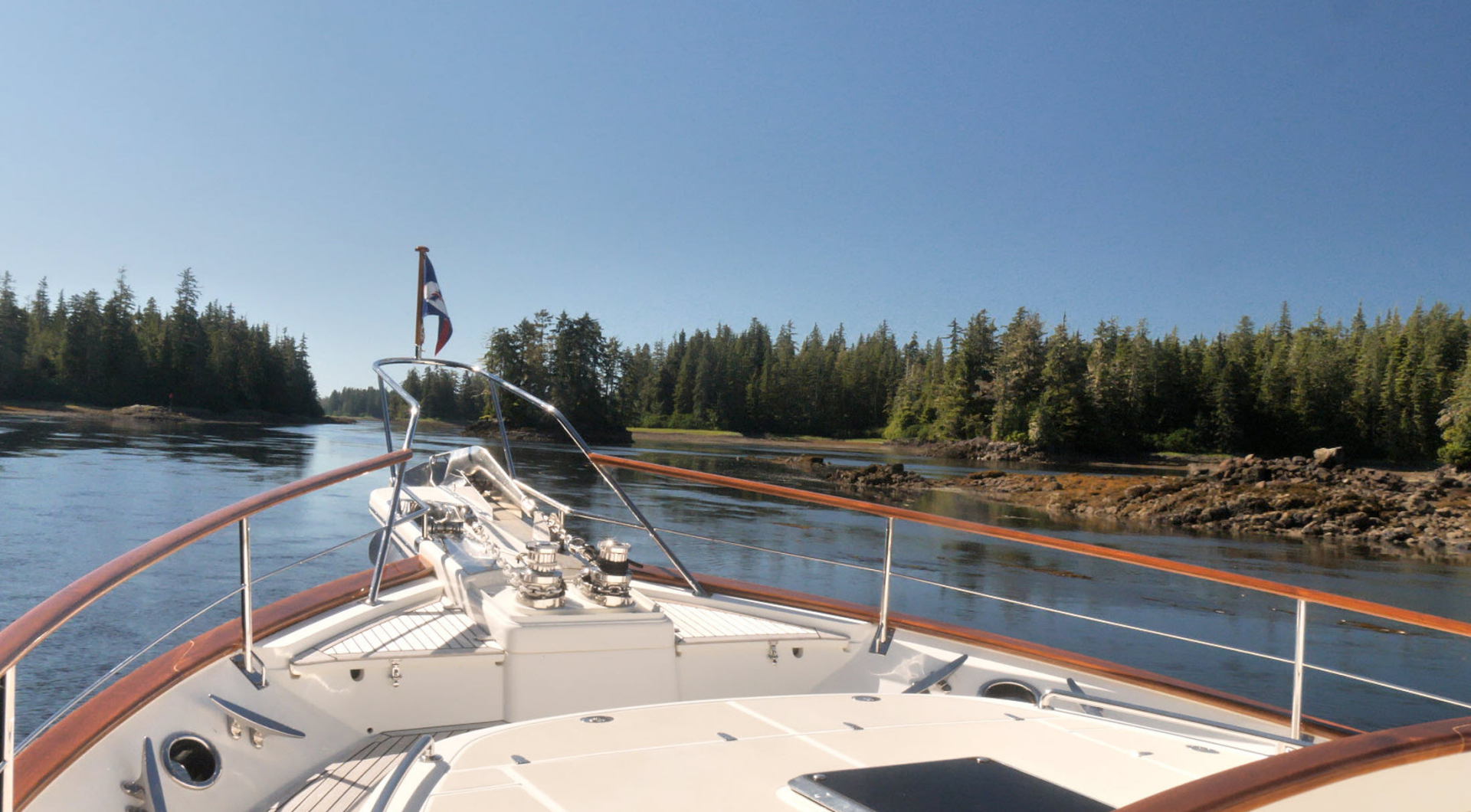
More travels along the exposed west coast of Baranof Island. One more brief stop at Sitka then goodbye to Baranof Island as we cross Chatham Strait to the next group of Islands to the East especially Prince of Wales Island. We make an unscheduled stop in Ketchikan before bidding farewell to SE Alaska for 2022.

July 14th Thursday

In Sitka. Steve’s flight is delayed from 0630 to a more civilized 0830. Provisioning. Dinner at the Beak restaurant. I send off Blog #3.

July 15th Friday

More provisioning. Dinner at the Magiare Italian restaurant in the Sitka Hotel.

July 16th Saturday

We visit the Raptor Center at 3 pm and have to admit that we find it a little disappointing compared to previous visits. This is because there are not so many birds due to risk of bird flu. We have dinner at the Channel Club out of town.

July 17th Sunday

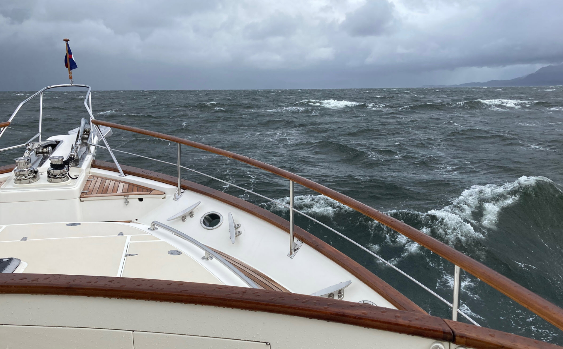
Underway at 0941. Grey day. Chilly with rain and forecast of winds of 30 kts. Very windy and rainy. Not a nice day at all. We go just as far as Sukoi Inlet located between Kruzof Island and the strangely named “PartofShikof Island” because venturing into open waters under the current rough conditions off a lee rocky shore would not have been either fun or sensible. As it is, we anchor at the very top end of Sukoi Inlet at 1220 with wind gusting to 33 knots where we spend a relaxed afternoon. Our next guest, Scott, arrives at midday.

July 18th Monday

Overnight the wind drops to almost complete calm. Misty clouds float over surrounding mountains clad with trees in good condition. We have just one bar of cell coverage but I am able to receive an enquiry from German TV re the possibility of using some of my footage of Lituya Bay. We get underway at 0950. The seas in the open Gulf of Alaska are quite rough – traveling up the coast with ominous skies and spray bursting on submerged rocks. How much worse it would have been if we had continued yesterday. Conditions calm down as soon as we turn into Kimshan Cove on Chichagof Island at 1337. There are some dilapidated shacks on the shore. Mist hangs across the mountains – occasionally descending to the surface of the water.

Venture at anchor in remote Kimshan Cove on the west coast of Chichagof Island.

July 19th Tuesday

Absolutely still morning. Chris flies the replacement drone brought by Scott who joined us in Sitka. Underway at 0803. We travel further north through relatively low-lying Islands. Misty with light rain. At 1017 we anchor in Kleg Bay off an abandoned Chichagof Village which, in 1938, had over 200 inhabitants and was the site of a gold mine that produced more than $13 million worth of gold and $1m in silver between 1905 and the late 1930’s. Not much is left today other than some rusting equipment on the beach. The mine was established after two young Indians made known the presence of gold in a local stream. This whole area is an absolute maze of islands with many otters inhabiting the surrounding waters 

We had thought we might stay one or two nights here to explore the abandoned “town” but with there being so little remaining was not much left to explore so we decide to move on. We up anchor at 1414 and go first to Waterfall Cove but decide it is too exposed so we move on to adjacent Falcon Arm where we anchor at 1618. The anchor drags through soft mud but Chris decides to allow time for it to set. This is a very nice spot with trees standing tall on amazingly steep hillsides. However, there are many dead trees at the entrance and also in Slocum Arm. We believe these are yellow cedar whose roots are vulnerable to freezing when there is a lack of snow to protect them.

July 20th Wednesday

Heavy rain when we awake. Up anchor at 0745. We head out into the open ocean where it is pretty rough as the waves and wind are against us. As we turn into Frederick Sound we hear a Mayday call from a charter fishing boat re a client who was seasick and then had a heart attack. They are performing CPR on him as they race to the northern outskirts of Sitka. They pass us at speed and we can observe them performing CPR in the small boat cockpit as they race past. We tie up in Thompson Harbor at 1310.

Chris has determined the most likely cause of our trouble with the chain counter is the sender in the windlass so, with the help of Kevin at Delta Marine Services he is able to have a replacement sent c/o of the harbormaster in Sitka’

July 21st Thursday

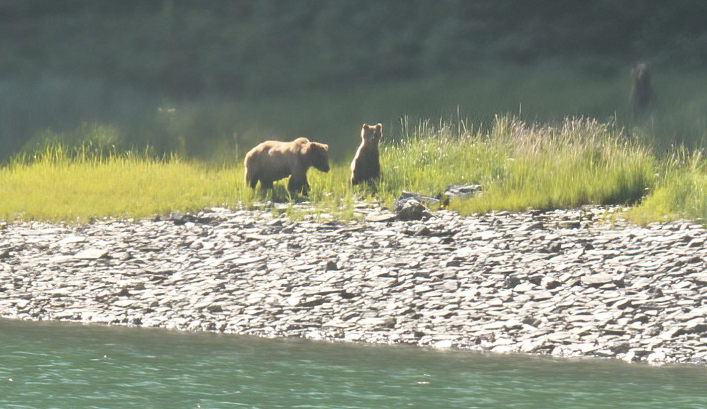
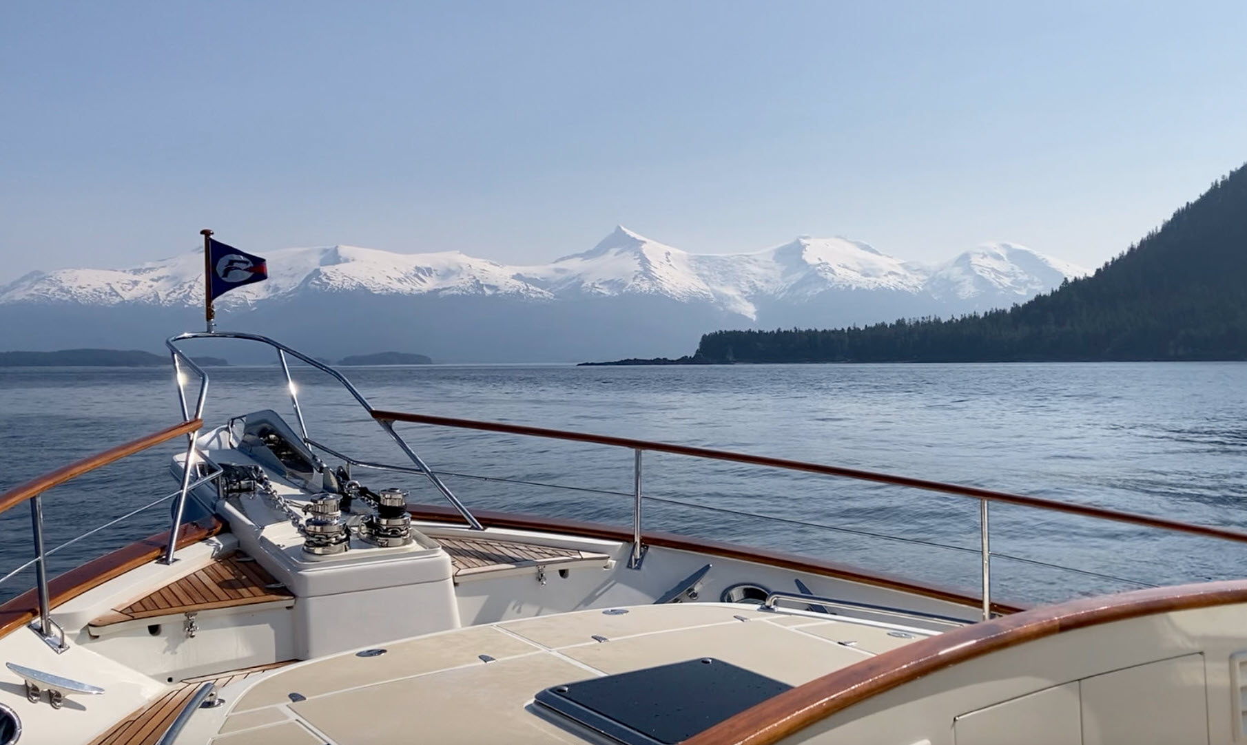
Underway at 0843. Amazingly, on our way out of the harbor, we spot Fleming 55, Mola Mola, moored at Fisherman’s Wharf. Quite a big swell was running once we leave the harbor. Nice sunny day out at sea with ominous looking clouds over the distant land. We see separate areas of foam on the water even well out to sea. We go to the head of Necker Bay and then around to Dorothy Cove where we anchor at 1420. We test Starlink and find it to be working. Scott flies the drone starting above the low clouds and down through them to reveal Venture at anchor. The anchor did not set to Chris’s satisfaction so at 1705 we raise it and return to the head of Necker Bay where we re-anchor at 1748. We spot a young, black-coloured, grizzly bear eating sedge grass.

Under misty skies and light rain, Chris works to replace the sender for the chain counter.

July 22nd Friday

The problem is that the replacement sensor is loose in the original bushing and cannot be fixed in place securely. Chris, assisted by Scott, finally resorts to using epoxy and we move on at 1306 with the chain counter tested and working. So – the faulty sensor was the problem. Would have been much quicker to replace had the sleeve into which it fitted on the windlass been able to hold the replacement sensor. As soon as we leave the shelter of the anchorage it is quite rough as we proceed south to aptly named Still Inlet where we anchor at 1515. Breaking waves on rocks make.the approach look quite intimidating. With Starlink working we are able to stream Sea Gypsies on Amazon Prime with few interruptions.

July 23rd Saturday

It is low tide and very calm when we awake. We spot two rocks which are not on the chart and of which we had been unaware when we anchored. Chris launches the new drone and takes videos and still photos plus we note their GPS location. We transmit this info to NOAA’s website for chart updates. We get underway at 0752 and while hauling the anchor Chris spots a mother bear with two tiny cubs – very young but old enough to be eating grass and turning over rocks. We are enveloped in thick mist and the water is sloppy outside but calmer than yesterday. The land is either completely invisible of just a dark shadow on the horizon.

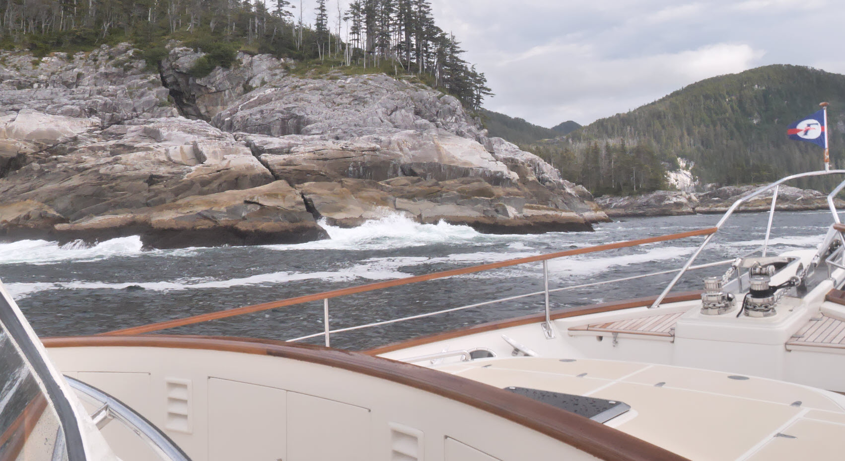
We round Cape Ommaney at the southern tip of Baranof Island at approximately 1130 This time we have a good view especially of Wooden Island – perhaps it should be called Wooded Island – which is an accurate description The sea calms down even before rounding the cape but continues much calmer across Chatham Strait. The coast of Kuiu Island is hidden in the mist until we are within four miles of it. From the entrance we can see one commercial and two private boats fishing. We anchor in what Douglass called Mud Hole in Port Malmesbury but has no official name on the chart.

July 24th Sunday

Awoke to serious rain. It’s good we are not suffering from heat and drought like most of the world but it would be nice to have a bit less rain and see the sun more often. Underway at 0828. It is quite rough when we leave Port Malmsbury but it becomes less so as we turn north and the weather is behind us. Quite a number of logs in the water which are not easy to spot in the rough conditions. We turn to starboard in between many islands and rocks into a small bay off Shelter Cove and anchor at 1115 in comparatively shallow water. We see numerous sea otters and Scott spots black bears very far away on the beaches of nearby islands. Rain continues on and off until early afternoon.

July 25th Monday

Awake to some sunshine. It is a lovely, dead calm, morning but clouds soon move in and the sun goes away. However, no rain which is a change. After breakfast, we all embark for an extended trip in the big tender through a narrow channel called The Eye of the Needle where we see a couple of bears. One is quite skittish but the other pays us little attention. We see a large group of otters on the way back. Christine and Scott use kayaks to explore the shore around the anchorage. Chris shoots drone footage.

I receive a message forwarded from Nicky from John Thomas re Carleton Mitchell’s boat, Lands End. I respond and he sends me a copy of an article from Yachting magazine in which I receive a brief mention. Even though there is no fog where we are, we hear big ship sirens every two minutes indicating fog in Chatham Strait.

July 26th Tuesday

We awake to dense fog but it does not last for long in our anchorage. However, it returns once we get out into the main channel but it comes and goes throughout the day. We come across a group of large whales bubble feeding but I miss the main event of them surfacing immediately forward of the bow as I had gone aft having spotted a lone whale. The fog returns and we lose sight of the whales and continue on our way. We turn into Frederick Sound and see the town of Kake in the distance before anchoring at 1425 in Dukaneek Bay on Kupronof Island.

July 27th Wednesday

We awake to a really beautiful morning and a seriously minus tide. We do not get underway until 0905 because we want to delay reaching the Keku Straits (aka Rocky Pass) until the start of the rising tide. We had avoided this strait in the past because of its reputation but recent research has indicated that perhaps the risks had been overstated and the safe route through it is well marked.

Venture’s displays simplify navigation through Alaska’s tricky inland passes.

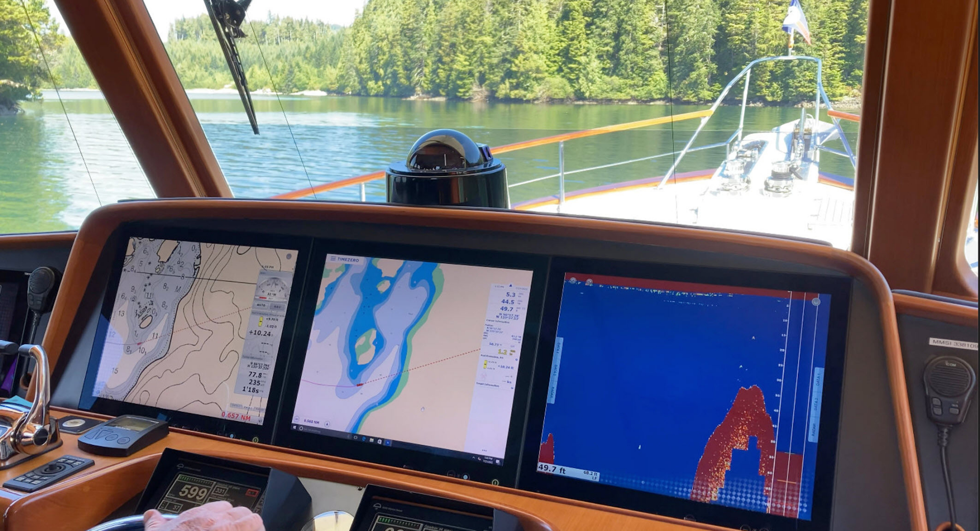
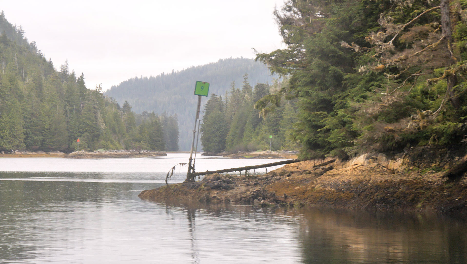
We are traveling from north to south which means leaving green, square markers to starboard and triangular red beacons to port. The green beacon at Entrance Island has fallen over. Most of the markers are OK but there are some – no longer on the current chart – which have toppled and there are a few missing altogether that are on the chart. Navigation is not difficult but care is needed and we are down to having just three feet below the keel in one place even at high water slack. We fly the drone and also take some time-lapse footage which will eventually be combined into a video.

Venture enjoys a rare sunny day while passing through Keku Strait - also known as Rocky Pass.
Venture enjoys a rare sunny day while passing through Keku Strait – also known as Rocky Pass.

After a successful transit of Keku Strait, we drop the hook at 1404 in a very beautiful anchorage in the northeast lobe of Labouche Bay. Labouche Bay is named after stern wheeler which carried people between San Francisco and the Stikine river in the distant past.

July 28 Thursday

We awake to grey skies and a band of fog on the horizon. Another ultra low minus tide reveals a skein of rocks and skerries which gives the appearance of being landlocked – hemmed in by fog and rocks. So different from yesterday evening. We thread our way out between myriad islands and islets each wearing its wig of trees. Today we pass through Capitan Passage which to my mind is even more interesting and scenic than Keku Straits. Also it is deeper even though narrower. One narrow and short section is called Dry Pass so, presumably, has been dredged.

A starboard marker while heading south through a tight spot in El Capitan Pass.

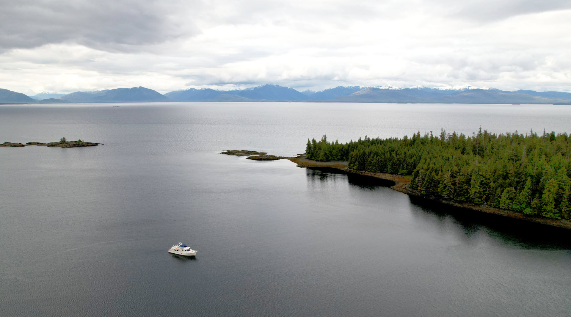
Capitan Passage separates Prince of Wales Island from Kusciusho Island. We see cars and a camper along the shore plus a dock for El Capitan Cave. Later we see numerous boats, docks, and vehicles on Prince of Wales Island. We anchor at 1435 in Kaguk Cove on Prince of Wales Island. There are many otters among the numerous islands in this area of Prince of Wales Island.

July 29th Friday

Overcast morning. Underway at 0743 to Craig. We crossed the Gulf of Esquibel which is open to the ocean and, even with many islands in the way, we could still feel the gentle ocean swell. We call Craig requesting a slip. They are very helpful but they are completely full. At 1114 we anchor in Crab Bay off the north harbour along with several seiners and fish tenders. Rain descends seconds after anchoring.

Craig harbor is packed while the commercial fishing fleet awaits an official opening.

July 30th Saturday

Scott has been suffering from dental problems for several days and his situation requires immediate attention. He is able to pick up a prescription from a pharmacy in Craig which, being Saturday, is only open 12 – 2. We decide we need to change our plans and head for Ketchikan right away so we get underway at 1322. We go through Tlevak Narrows against a strong adverse tide. I am in the pilothouse when huge whale leaps clear of the water right along the starboard side of the boat. I am the only one to see the whole event but it happened too fast to be able to take any photos.

We enter the northern edge of Dixon Entrance which divides British Columbia from SE Alaska.
We anchor at the extreme top of Nichols Bay at 2117. The bottom is rocky in places and we let out over 300 ft of chain. We have covered 76.77 nm today. There is a fish opening and we see many commercial fishing boats out working. Many use the same anchorage in the evening.

July 31st Sunday

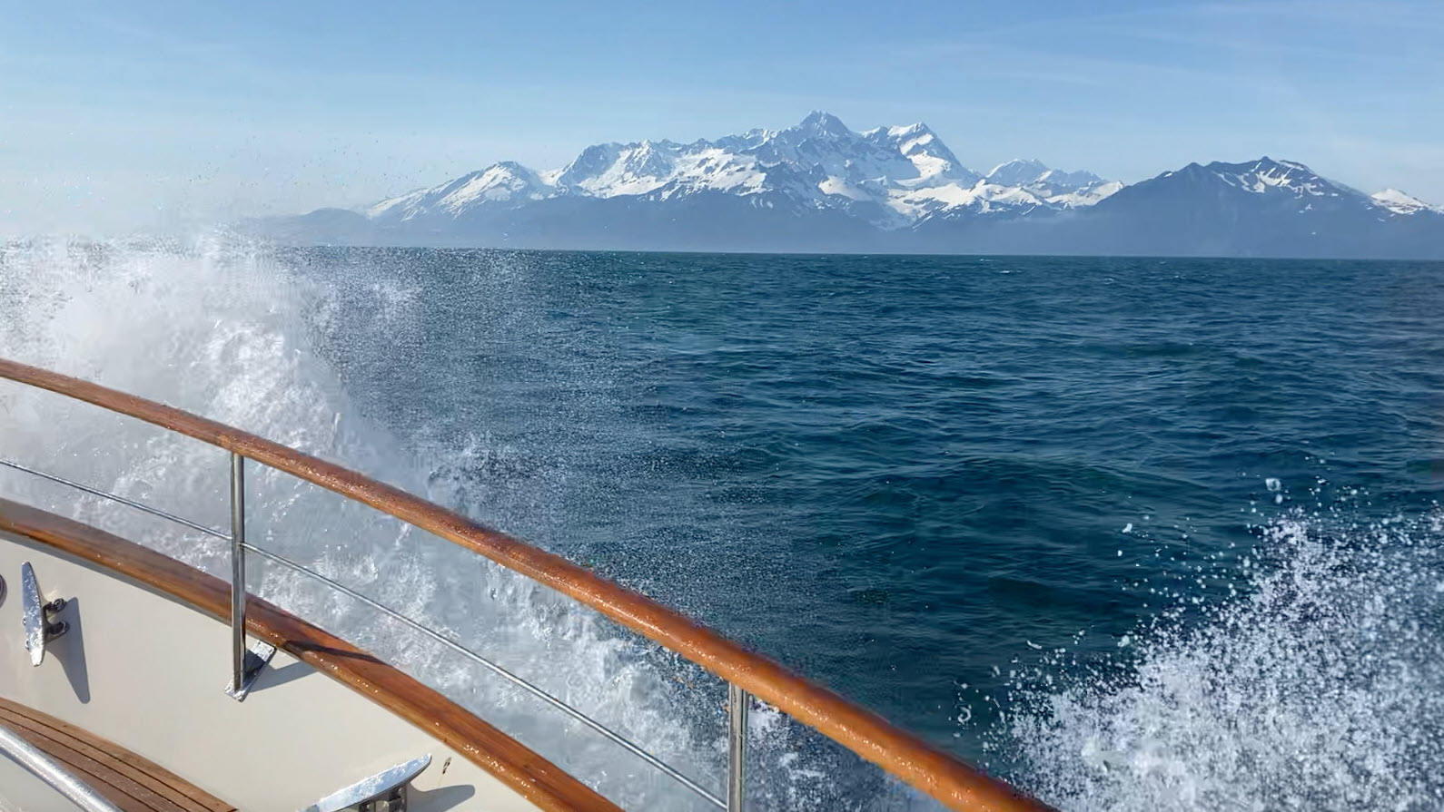
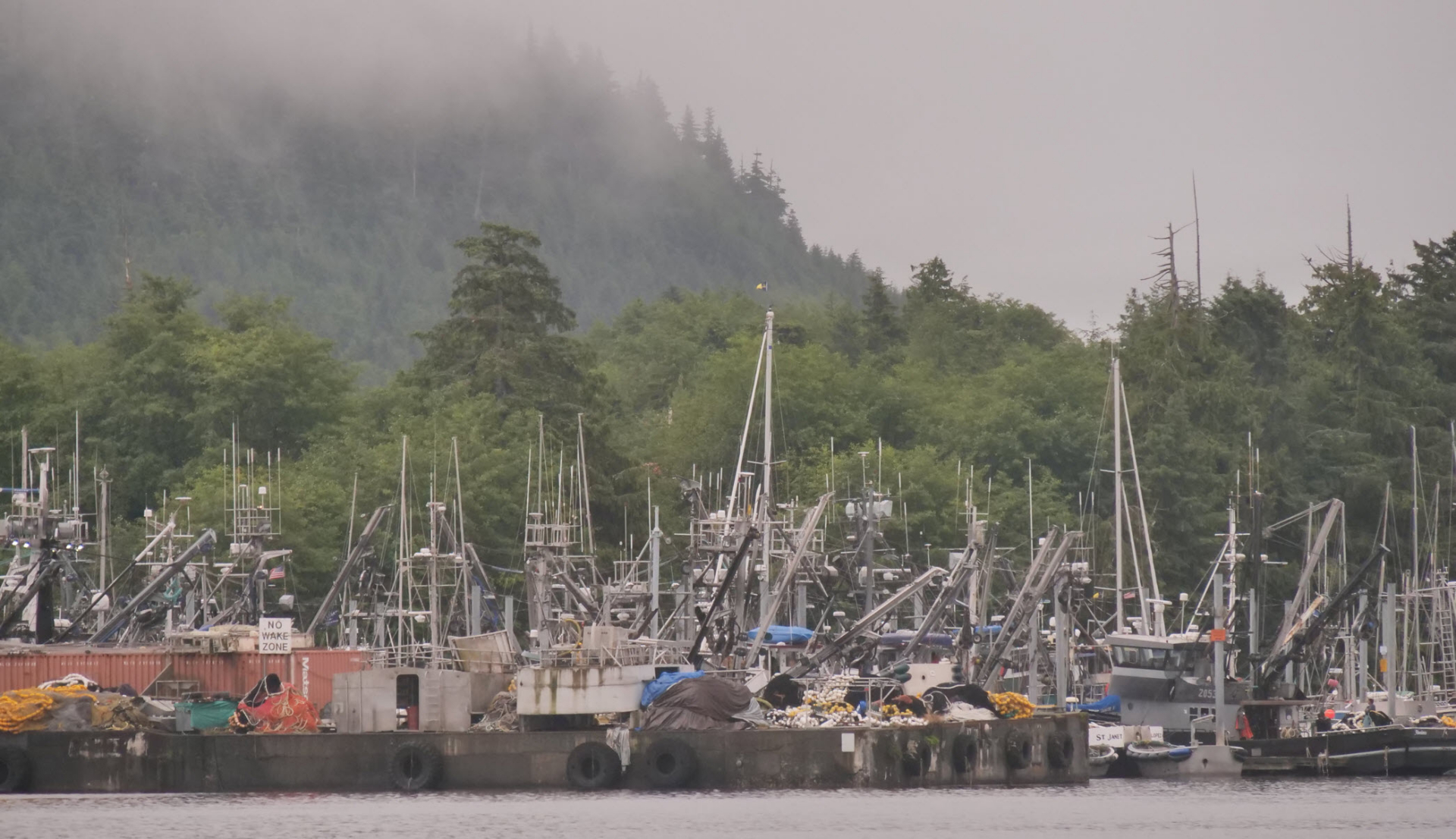
When pulling the anchor the chain comes up with a jellyfish clinging to the chain. We initially get underway at 0722 but masses of steam are pouring out from the starboard engine bypass outlet with no raw water alarm. We stop and Chris checks the strainer and Venture’s unique butterfly shut-off valve in the starboard exhaust. We drifted in the still. protected anchorage while this is going on. Eventually, we get going again at 0812 without really resolving the problem but the steam has stopped and everything appears normal. We assume it was due to a temporary obstruction probably something to do with jellyfish but that doesn’t explain why the raw water alarm failed to indicate an obstruction – and we know the alarm is functioning because we check it. One of those mysteries. Dixon Entrance remains calm as we move east along the southern tip of Prince of Wales Island. We reach Ketchikan without incident at 1327. There is no problem getting a slip in South Bar Harbour.

Hard to believe that this is the last day of August and from here we will be saying goodbye to SE Alaska and moving south across the border into British Columbia.

Venture Blog 3: Circumnavigation Of Baranof Island

Circumnavigation of Baranof Island

This Blog covers our circumnavigation of Baranof Island from Sitka and back to Sitka. Traveling south down the exposed west coat around the southern tip at Cape Ommaney and back north up the east coast and return to the West coast and Sitka through Peril Strait.

July 1st Friday

We have no problem obtaining a slip in Sitka although we initially go into the wrong one. We have to move to another slip which we are supposed to vacate by 0900 tomorrow. Chris and Christine go to the store to re-provision and our washer and dryer keep going nonstop all day. There are early 4th of July Fireworks but not scheduled until 11:30 pm due to it not getting dark enough until that late hour!

July 2nd Saturday

I walk up to the top of the ramp to take photos with fireweed in the foreground. Photos from this identical spot with the same fireweed have been taken by me on previous visits. Happily, I am able to film Venture moving from this slip to another where she showed off beautifully. A raven shows up while taking photos and was very chummy which allows me to take photos and video.

Venture Moored in Sitka
Moored in Sitka

I catch completely up to date saving photos and videos plus this journal. Have a mostly restful day having dockside conversations with people from an adjacent Nordhavn named Nutmeg. Plus people from another boat. Many commercial boats have left the harbor presumably for a fish opening. Unusual so close to July 4th.

July 3rd Sunday

Underway at 0924. Misty morning which transforms into a thick fog as soon as we leave the marina entrance. It does not lift until we almost reach our destination just 20 miles south. The Starlift – I christened Fred – starts working intermittently shortly after we leave Sitka. We anchor in Herring Bay on Elovoi Island at 1257 after 23.69 nm. Steve and Christine go ashore in a small tender with an electric motor. Chris flies our original drone over Venture and takes video of the crew on shore. They say they saw both wolf and bear tracks. Clear and sunny afternoon.

July 4th. Monday. Independence Day

Up anchor at 1015. It is sunny with high mist. We thread our way through groups of islands – in a couple of cases through channels which appear wide but where the navigable channels are tricky and narrow. We pass many starkly white dead trees standing like bleached skeletons. According to what Christine reads on the internet these are predominantly yellow cedar whose roots, unprotected by snow, have been killed by freezing temperatures. The mist comes and goes drawing veils across the islands. The effect is lovely and allows me to shoot some beautiful video. In one case we are so close to the trees that a hazy sun casts moving shadows across the deck as we slide past.

We turn up a 10 mile long fjord called Crayfish Inlet and there is some debate about whether or not to continue right to the end. In the end, I decide that we would and we are very pleased with the decision. As we reach the remote head of the fjord we see salmon jumping which helps to confirm our decision to stay. The water is absolutely crystal clear. Steve and Christine go ashore in the small tender and explore a running stream where they report seeing numerous well-established animal tracks.

The Starlink is now working remarkably well right at the limit of its currently published range. I send an e-mail to the harbor master in Sitka to see if they would receive a package on my behalf from Amazon and if so what would be the correct address. He answers promptly which impresses me – this being the 4th of July. So I order three SD cards from Amazon to be delivered to the Sitka harbor master. We will be back there on the 13th.

Chris flies the drone a couple of times today including one flight in the evening demonstrating our remote location. Beautiful sunny evening

July 5th Tuesday

Up anchor at 08.35. Overcast with low cloud. Slight rain. When we reach the open sea fog descends. It is quite rough with spray all over the boat. The fog lifts after a while and we can just detect the distant shore. We notice a number of fishing boats working.

At 1243, we anchor in an officially un-named inlet which Douglas called Rene’s Relief. The entrance is rocky and dramatic with breaking waves.

Venture entering an unnamed bay

Once inside it is calm. The hillsides carry many dead yellow cedar trees After we anchor the others pick out another anchorage on the chart which they think has more potential for expeditions ashore so we raise the anchor at 1355 and go about 8 nm south to Redfish Bay which runs quite a way inland and has one very narrow spot before opening up into a larger bay. We drop anchor at 1500.

July 6th Wednesday

We remain in this anchorage all day. Christine and Steve head off in a small tender for a long trip and a trek up the river to Lake Tumakof which feeds the river. We see salmon jumping and watch an eagle in the distance eating a fish. Another large motor yacht enters the bay – sharing an anchorage along this coast is a rare event! I go for a short tender ride along the shore with Chris in the big tender. We spot a brown bear along the shore. Chris shoots two lots of drone footage today.

July 7th Thursday

Early morning drone flight by Chris recording reflections and mist on the mountains. Underway at 0759. Mist turns to fog once we reach the ocean which is very calm. Foggy most of the way down the coast until we round the southern tip of Baranof Island at Cape Ommaney We pull into the small settlement of Port Alexander and tie up at the dock at 1030.

Venture at dock behind fishing boat TEASHA with a field of daisies in the foreground
Venture at dock behind fishing boat TEASHA

We go for walks along the main boardwalk – named Main Street. Cute place and very quiet. Have lunch on board then leave at 1344 heading up the east coast of Baranof Island to Little Port Walter where we moor at 1406. We have moored here before. There is an onshore NOAA Fisheries Research Station which has been here since 1934.

July 8th Friday

Up anchor at 0759. Misty with light rain. Quite foggy once we get out into the channel. Looks like we are not going to see much of the mountains today. We proceed north in calm but misty weather with mist hanging about 200 ft up above the water. Going into Red Bluff is considered, but decide against it after seeing so many other boats already there and we have visited this lovely spot twice in the past. We take a short diversion into Cascade Bay to photograph the spectacular waterfall.

Venture at waterfall in Cascade Bay

We continued north into Warm Springs Bay but there is no space at the dock so we continue north to Takatz Bay. There is already a large motor yacht plus two other boats at anchor. More boats arrive later. Low clouds, grey and rain. We lose connection via Starlink but have 1 to 2 bars of AT&T.

July 9th Saturday

Misty morning with intermittent rain. I go out in the big tender to the river at the head of the bay with Steve and Christine. It rains all the time so cannot use my Lumix camera to shoot video. However, I am able to use my iPhone with excellent results. After lunch, I stay aboard while the others go out in the small tender to hike to a waterfall at the head of the bay.

At anchor in Takatz bay

July 10th Sunday

Awake to a rainy, misty morning. It stays that way all day. We get underway at 0944 and make our way south to Warm Springs Bay. When we arrive at 1055, the dock is already occupied with additional boats at anchor. We decide it is not worth stopping there so we leave and head back north. We encounter many large vessels en route. Rain and wind from south up to 30 knots. We divert and pause at Waterfall Cove to enjoy and photograph the huge waterfall. We turn into Peril Strait and anchor in Appleton Cove at 1533. Winds 20 knots overcast with low mist and rain. First attempt at anchoring on western shore is not successful so we relocate to western shore. Three other boats are already anchored in the cove.

July 11th Monday

Awake to rain and mist but the wind has dropped. Underway at 0754. Head out of Appleton Cove into Peril Strait along Deadman’s Reach and pass the entrance to Poison Cove named for an incident in 1799 when over 100 of Baranof’s Aleut hunters were poisoned by eating shellfish during a rest stop here. An agonizing death meets them at Deadman’s Reach within two hours.
Even today, eating personally harvested shellfish is a risky proposition which can result in Paralytic Shellfish Poisoning (PSP) and is not recommended. We pass through Sergius Narrows at slack water in thick mist and spotty rain and anchor in De Groff Bay on Krestoff Island at 1245 which has a narrow entrance with submerged rocks to port and starboard.

July 12th Tuesday

Very low minus tide this morning. The narrow entrance appears pretty well blocked from afar. Chris flies the drone over it but it looks more practical from that view. We get underway at 0936. Chris suggests shooting a drone shot of Venture passing through the entrance, so he flies the drone while I pilot Venture through the gap. From the drone footage, it looks really simple but strong currents push Venture off course. Fortunately, our fly-by-wire steering is very precise. As we approach Sitka we see huge cruise ships in the distance including Odyssey of the Seas with a 4,500 passenger capacity plus numerous crew. Some of the latest cruise ships have more than 6,000 souls on board!

We divert well offshore to St. Lazaria Island. 21 species of birds nest on this island – one million birds in all. Large swells from the open Pacific burst upon the rocky shore.

birds on St Lazaria Island

I shoot lots of video and am down to just 14 minutes left on the SD cards. I hope that additional cards will arrive in time at the harbormaster’s office! One rock outcrop has a large hole right through it, We cross to the mainland and anchor in Camp Cougan Bay just south of Jamestown at Sitka.

I note that Fleming Yachts You Tube Channel passes 75,000 subscribers today. Yaaaay!

July 13th Wednesday

Beautiful still morning with some sunshine and broken clouds. Lovely scene with a derelict barge on ultra-low minus tide.

beautiful mirror reflection of a lake with trees and a snowy mountain. Camp Cougan Bay just south of Sitka.
Camp Cougan Bay just south of Sitka.

Christine and Steve go ashore in a small tender. We enter Sitka from the south and stop at the fuel dock where we take on 830 USG @$5.44/gal. $4837.35 with taxes. Then we move to the marina where we tie up at 1154. Our plan is to be here for four nights. Steve D’Antonio is leaving us here and another guest will be joining us.

Venture Blog 2: From Auke Bay To Close By Sitka

Venture re-visits SE Alaska. June 2022.

The main place of interest in this blog arises from our last-minute decision to re-visit the infamous Lituya Bay located off the Gulf of Alaska about 40 miles north of Cape Spencer. A detailed account of the history of this bay can be viewed in my video “Venture to Lituya Bay” made after the first trip we made to this beguiling destination in 2013.

This blog begins in Auke Bay which is a few miles by road from Juneau but several hours by boat as the sea route requires you to go all around Douglas Island to get from one to the other.

June 20th Monday

For the first time in ages we are able to lie abed until 0700 which is quite a luxury. Chris and Christine head off to do massive grocery shopping at Fred Myers. I spend the day turning my journal into my first blog and sending it on its way.

June 21st Tuesday

I select and transmit a few photos for the blog I sent yesterday. This takes pretty well the whole morning including selecting the photos, capturing a still from video, adjusting the size, and uploading.

Chris sets out to see whether he could find a shop which could remove the original magnet from the anchor windlass chain counter and replace it with a new one. One problem is that the original magnet is 10mm in diameter and we can only obtain non-metric sizes here.

We go out to dinner at a Thai restaurant. It was a long walk to the marina ramp.

June 22nd Wednesday

Chris spends more time and makes a couple of phone calls to Kevin at Delta but despite all his efforts is still not able to get the chain counter to work reliably. We use very high-quality s/s anchor chain from Germany but it does not readily accept paint and it proves very difficult to keep painted length markers on it. It is imperative we know how much chain has been let out so we rely on the chain counter. We decide to order another sensor for our next guest to bring with him when he joins us in Sitka. In the meantime, we decide to install different colors of cable ties onto the chain at 50ft intervals using a 50ft length of marked line to let out with the chain to measure the lengths.

The Riviera adjacent to us moved out in the morning so with it out of the way, I am able to get better photos of Venture. Chris and Christine head out for another major provisioning mission. We need to have sufficient food on board to last four people for four weeks.

Venture moored in Auke Bay.

Chris went to Juneau airport to pick up Steve D’Antonio whose plane arrives at 9.06 pm. We sit up and chat until about 10.45. 

View of marina in Auke Bay.

June 23rd Thursday

Really beautiful weather today. Sunny and a little warmer with a view of the snowy mountains.

Christine goes for her usual morning walk while Chris starts the installation of the Starlink which Steve has brought with him but he finds he needs some hose clips of a smaller size than we have on board so he goes into town to get some. With these in hand and installation complete, Steve tries to fire up the Starlink but without success. We knew we were outside the published coverage area so is not unexpected but we had been hoping otherwise.

June 24th Friday

We arise just after 0600 and leave for the fuel dock at 0735. Taking on fuel 475 usd @ $5.52 per gallon. We depart Auke Bay fuel dock at 0810. Then we pass the small town of Hoona which has three cruise ships moored at its docks. We also notice new facilities such as a cable car with gondolas rising high up into mist-shrouded mountains and what has been billed as the fastest zip line in the world. We continue past Hoona into Port Frederick and anchor in the North Bight of Neka Bay. During the day the clouds dissipate and turn into a beautiful evening with distant peaks reflected in still waters.

June 25th Saturday

Up anchor 0833. We retrace our route out of the anchorage and over the glassy waters of Port Frederick towards Hoonah.

Drone shot of Venture underway in Frederick Sound.

Chris suggests this would be a good opportunity for a drone shot of Venture proceeding through mirror still waters but the surface is ruffled by the time the drone takes to the air. We have cell phone coverage off Hoona but not sufficient to connect to the internet. Turning left into Icy Strait we need to cross to the other side to stay out of the way of a small cruise ship. We have distant views of the magnificent coastal mountains. We pass Lemesurier Island and are heading for Dundas as our evening’s destination when Chris suggests we take advantage of the rare calm conditions and head instead to Lituya Bay.  After some discussion, we decide to at least take a look at the sea conditions in the Gulf.  We could already just see Cape Spencer lighthouse in the distance through binoculars. So…. sharp left turn into Cross Strait and we head towards the open waters which are already within line of sight from our present position. When we reach the open sea, the sky is a clear blue but the wind is gusting to 20 knots from the north-east – our direction of travel!  We decide to proceed but we will arrive too early at the tricky entrance into Lituya Bay some forty miles away so we turn into Dick’s Arm which appears on the chart to be dramatically narrow with steep contours on either side. It turns out to be a lovely spot extremely peaceful compared to the boisterous conditions outside its narrow rock-strewn entrance.  We anchor at the end of the inlet and enjoy an early afternoon tea while we wait so that we will arrive at the entrance to Lituya bay at around slack water at 2200. On the way back out of the Dicks Arm we spot a mother brown bear with two cubs. One stood up to get a better view of us but his mother paid us no attention and continues browsing on sedge grass.

Mother brown bear with cub in Dick’s Arm inlet.

The weather is against us and the seas are choppy with volumes of wind-blown spray hurling itself against the windshield. A commercial fish boat also heading north behind us calls on the radio. He is heading to Valdez in Prince William Sound so he has a long way to go. The coastal mountains are staggeringly beautiful and dominated by Mount Fairweather which rises 15,300 feet straight up from the sea.

Mount Fairweather seen from Venture.

We pass LePerouse glacier – named after the French Admiral who in 1786 suffered a calamity in Lituya Bay. It is hard to stop taking photos and video. Finally, we arrive off the entrance to Lituya Bay marked by a couple of conical hills named The Paps. The seas are somewhat rough and the far-range marker is not visible but we have no problems following the course on the chart. We drop anchor at 2200 just ahead of sunset officially listed at 2223. 

Venture at anchor in Lituya Bay.

Massive snow-capped mountains dominate the bay but the sunset produced no color. We have the bay entirely to ourselves.  Few people visit this place with its fearsome reputation. Mist slowly steals across the water concealing the mountains from our view. We cover 107.4 nm today.

June 26th Sunday

It is very chilly overnight and we awake to find ourselves embraced in a curtain of solid mist. This gradually clears to reveal the breathtaking mountains rendered even more dramatic wearing a shawl of mist. During the day we make several expeditions in the tender throughout the bay including a visit to the colony of black-footed kittiwakes which nest on the cliffs at the southern end of Cenotaph Island.

Black footed kitiwakes on Cenotaph Island, Lituya Bay.

Later, everyone other than myself went ashore at the site of the massive rock fall which had caused the 1958 record-breaking tidal wave.  Sixty-four years later the tree line marking the height of the wave can still be clearly seen.

Mountains hidden in clouds - Lituya Bay.
Mountains hidden in clouds – Lituya Bay.

June 27th Monday

We again awake to thick mist but this time it hangs about 600 ft above the water. We raise the anchor at 0837. Steve drives the big tender down to La Chausee Spit and we drive Venture down to what is shown on the chart as an Anchorage in the same area. Here we drop the anchor but there is quite a swell causing Venture to roll back and forth. The plan was for us all to take the tender to the shore and for the others to land and for me to take the tender back to the boat. The others would then cross the spit to the gulf side for some beach combing while I remained on the boat. However, we could not find a safe place to land so we were heading back to the beach area when we spot first a pair of herons and then a mother bear with two small cubs who were cavorting and racing back and forth along on the only rock-free piece of beach among the rocks. We stop the tender to watch and, although still well off the beach, the mother bear eventually spots us and continues along the rocky area of the beach. By now we decide not to go ahead with beach landing and start to return to Venture when Chris spots a large male bear on the beach following well behind the mother and cubs. 

We decide to leave right away even though the tide is flooding as the entrance looks ok. We have no problems and the entrance is not unduly rough. Once through, our journey south is comfortable with the wind and seas now from aft.

The coastal mountains are initially hidden behind a blanket of mist which dissipates over a relatively short period of time to appear in all their magnificence. As we draw near Cape Spencer lighthouse we pick up a cell phone signal of as much as 2 bars with the phone placed in the pilothouse. We continue south with wind and waves slightly on the beam and anchor in the North Arm of Takanik Bay on Yakobi Island which is separated from Chichagof Island by narrow Lisianski inlet. It is overcast but blissfully calm even though the winds outside are blowing at a boisterous 18 knots.

June 28th Tuesday

Up anchor at 0856 we leave the protection of the bay and head out into a turbulent Gulf of Alaska. Initially, the waves are somewhat on the beam but this improves as we turn more south. We stay well offshore and quickly lose sight of land in the mist. While well out to sea we see a charter fish boat stationary and rolling in the waves with several people standing in the cockpit and one at the bow fishing. It seems to me to be a most uncomfortable pastime!

The first sight of land is the white of breakers through the mist. We make our way into Salisbury Sound and anchor in Kalinan Bay on Kruzof Island at 1345. There are three other boats in the bay.

June 29th Wednesday

We awake to another misty morning. I stay aboard to work on this blog while the others go ashore in the small tender with its electric outboard to do some beachcombing along the rocky shore. We do not get underway until nearly noon as we only have a short distance to go to our next anchorage in an unnamed bay on Magoun Island about nine miles north of Sitka. We have used this anchorage on two previous occasions and intend to remain here for a couple of days.

Venture anchored in un-named bay on Magoun Island.

June 30th Thursday

A restful day spent in one calm and secluded spot. We have tentative cell phone coverage so are able to catch up with e-mails and limited internet. Christine and Steve go ashore to bash their way through dense forest. Chris catches up with maintenance issues and I spend more time on this blog plus some cooking. The skies are clearing and there are patches of blue.

Tomorrow we head for Sitka.

Venture Blog 1: Sidney BC to Juneau

Venture in Southeast Alaska

Venture Re-Visits Southeast Alaska – May 2022

June 4th Saturday

Underway 0728. We had to go “round the flag” at Roche Harbor to get our Canadian Cruising Permit. When provisioning in Canada we had overlooked that we are not allowed to have on board any fruit, vegetables or meat when entering the USA. so, yesterday we offloaded all of our provisions into another Fleming moored at Delta Marine. We crossed the US border at 0840 and Chris called up US immigration and got us cleared in. We did not have to tie up at the customs dock. We then turned around and headed back to Delta and encountered Blue Pearl and Bonito on the way. We stopped at the Canadian customs dock at Van Isle and Chris called in to log us back into Canada. No problems.

We then tied up at our previous dock at Delta at 1020 and reloaded our provisions. We finally and seriously got underway at 1032. No issues during our journey to Nanaimo where we anchored at 1515. En route, we passed through Dodds Narrows where we had two knots in our favour. No other boats. Overcast all day. Occasional rain. I checked the camera on Mac mini connected to TV in fwd cabin. System worked well but saw spots on video only. Tests narrowed it down to the camera sensor.

Anchored off the pub in Nanaimo Harbour at 1515. Christine cooked a nice dinner of chicken with gooey rice and asparagus. I tried to get Garmin InReach going, not sure whether I succeeded. The instructions are ridiculously confusing. Quite cold below decks.
63.8 miles today.

June 5th Sunday

Underway at 0655. More like November than June. Exited the anchorage through the harbour which Chris said is 1/2 mile shorter. The chain counter on the windlass remote stopped working. Heading north up Georgia Strait – quite windy and rough but from aft so no problem.

Took photos of sailboats and freighter. Comfortable ride for us with following seas. Strait of Georgia is 110 miles long and 20 miles wide. 20 knots from SE and can be really nasty Hit 14.3 kts surfing. Vessels heading south were having a hard time.

Entered Seymour Narrows at 1435. 4 knot current helped us through. Anchored in Camelion Harbour on Sonora Island. Windlass counter worked OK. 99.86 nm today.

June 6th Monday

Underway at 0649. Cold with light rain. Lovely clouds over the mountains. While at anchor, genset shut down due to blockage in cooling water intake. Chris switched to alternate intake and after a few minutes genset shut down again. Caused by jellyfish in intake strainers.

Uneventful passage up Johnstone Strait. Had both wind and tide behind us most of the way. Traveling up to 11.2 knots at just over 1200 rpm. Arrived at North Island Marina at 1401. Bruce met us at the dock. SE wind at `10 kts. Temp 57.8 F – with windchill 55F. 71.84 nm today.

June 7th Tuesday

47 degrees F. this morning. In view of the weather, decided to go across to Cape Caution today. Ideal conditions. Departed Port McNeill at 0835. Had phone coverage until we were into Queen Charlotte Sound. No problems. During crossing Had a hard time deciding where to spend the night. Tried to anchor in Warrior Cove but too rocky for the anchor to hold. Eventually went to Kisamet. Anchored at 1838. I cooked two versions of Shepherd’s pie. One for Chris and self and another vegetarian for Christine. Two other pleasure boats at anchor plus one fish boat came in while we were trying to get the anchor] to set. 96.51 nm today.

VENTURE at North Island Marina, Port McNeil, Vancouver Island.

June 8th Wednesday

Departed 0658. Lovely light this morning. Occasional light rain. Able to get phone coverage while passing Bella Bella and, by using phone Hotspot, connected computer to the internet. Had a storm forecast and were expecting rough conditions while passing Ivory Island lighthouse but the conditions turned out not to be anything like we were expecting although some quite big swells. Got some good still photos and video of the scenic lighthouse. Turned into a lovely day with beautiful clouds with occasional rain showers. Anchored in Bottleneck at 1347. Already five boats there. With ourselves and later arrivals eventually reached a total of 10 boats. The most we have ever seen. I cooked pork chops with roast potatoes and sauteed cabbage with wine for dinner. Miles today 64.35.

June 9th Thursday

Up anchor at 0650. Rain and gloomy. Videos and photos of waterfalls which were impressive due to the rain. Made a diversion at Hartley village so could briefly connect to the internet and e-mail. Rained all day. Winds gusting to 40 knots. Anchored at 1648 in Exposed Inlet off Klewnugget inlet. Narrow channel between underwater rocks. Christine cooked beef bourguignon which was really good. 93.26 nm today.

June 10th Friday

Another grey day with intermittent rain but no wind. Underway at 0708. Itchy night from bugs in Bottleneck. Rained on and off during the day. Lots of waterfalls running fast. Had a quick look at Butedale. More clean up but did not look as if anybody was there. Wind up to 30 knots from aft and the day finished up with broken clouds and patches of blue sky before rain returned. Saw BC ferry Northern Expedition heading south. Anchored at the inner end of Brundige Inlet on Dundas Island. at 14.32. Was finally able to get In Reach to work. 76.73 nm today.

June 11th Saturday

Rain overnight but just grey in the morning. Underway at 0705. Forecast not too good for crossing Dixon Entrance with gusts up to 35 kts but all weather from SE so we went ahead with crossing. We surfed as much as 14.3 kts with throttles set to 1175. The seas and sky looked quite ominous but not as bad as forecast and with weather from aft quite a smooth passage although plenty of whitecaps. Crossed the border back into the US and had good internet. Took a lot of video of the waves etc on iPhone which is actually better than that shot on Lumix. Watched it on TV in fwd cabin and it sparkles. Had a hard time finding a berth in Ketchikan. Finally found one at Doyon’s Landing which is about one mile south of the town center and cruise ships docks. Tied up at 1135. There were three cruise ships docked. in town. One a Carnival ship and also a fine-looking Disney Wonder. We took on 1098.9 USG of diesel which was delivered by road tanker. The slip is quite exposed but the people are very nice. We were joined by an Offshore 95-footer and later by a massive Fedship named Ice Bear. It was raining on and off.

VENTURE crossing Dixon Entrance.

Clocks fall back one hour here.

Went out to dinner by taxi to Cape Fox Lodge. The main dining room was full but we ate in the lounge with chairs rather too low for the table so had to eat doubled up. 55.97nm today.

June 12th. Sunday

Chris and Christine walked into town to the supermarket to pick up limited supplies. Round trip walk – 6.4 miles! They got back seconds before a heavy rain shower. Huge cruise ship came by Celebrity Millenium. Other huge cruise ships docked Carnival Splendour and Celebrity Soltice. Underway at 10.10.

Overcast with nice clouds. Got to Myer’s Chuck at 1400 just after a float plane landed. The dock was completely full so we attempted to anchor. This was not successful in deep water with rocky bottom. As we could not tie up at the dock and walk ashore, we decided to go elsewhere so pulled anchor at 1410 and left. After some discussion decided on Ratz Harbor on Prince of Wales Island. Nice anchorage with a view of Clarence Strait. Anchored in deep water at 1555. Let out 400 feet of chain. 50 ‘ feet of which from below sole in anchor locker. Lovely views of distant snow-covered mountains with sun on them. Chris launched the new drone. It is so tiny it is impossible to see it when in the air so forced to use the iPhone screen which is the correct method anyway. 51.26 nm today.

VENTURE anchored in Ratz Harbor.

June 13th. Monday

Perfectly still morning. Overcast. Ships in the Strait heading south left a wake which took a long time to reach us and gently rocked the boat. Videoed it coming across the still water. It turned out we had let out almost the entire 400 ft of chain and the rope tied to the bitter end was almost at the point of coming up on deck. Chris was not satisfied with the strength of this rope and felt it was too long to the extent that it would go over the bow roller so he decided to add a second shorter rope. This was done and in the process the whole anchor locker was cleaned out and washed down. This drains directly overboard so no problem with dirty water running throughout the boat. Finally got underway at 0943. We encountered a group of Dall dolphins traveling at great speed. They stayed for a while passing extremely close to the bow and only surfacing to breathe for the briefest of moments. I later brought a video clip into FCP editing system and was able to determine that they do not breathe out underwater and breath in and out in about 2/3 of a second! I estimated this by counting the frames at 30 frames/second. We entered Wrangell narrows at 1415 with a strong tide against us. Met a tug towing a large barge but were able to take a side diversion channel to avoid it. Had to keep a slow speed because of the many small fishing boats in the channel. Chris called ahead and was able to get a berth in Petersburg for two nights. On approach to the harbor, we spotted a Fleming which turned out to be Mola Mola! Amazing! We have run into them by chance in so many places from Alaska to Mexico. We tied up at 1630. We had dinner on board cooked by Christine. 63.63 nm today.

June 14th Tuesday

We have been getting underway each day at around 0700 but arose today slightly later. Sunny morning but soon turned gloomy. Chris and Christine went out for breakfast while I stayed on board. Christine went to see a local friend while Chris worked on opening the windlass and found the magnet used to signal rpm was grungy with crud. I spent most of the day working on and organizing photos and, after much trouble, posting a couple on Facebook.

We went to dinner early at 4.30 at Inga’s Galley and there ran into the crew from Mola Mola and their friends who just arrived from Newport Beach. Another coincidental meeting!

June 15th Wednesday

Awoke to a beautiful sunny morning without a cloud in the sky but very chilly at 49 degrees. Slowly, mist appeared which morphed into thick fog by the time we got underway at 0835. We felt our way through the fog avoiding the many small fishing boats that were out there. It cleared when we reached more open waters. We saw our first ice in the distance and the mountains looked lovely with a lot of snow. I always feel that the real Alaska starts at Petersburg. The wind was now from the northwest at 15 -17 knots and there were plenty of white caps and spray over the boat. I took some shots with the iPhone which came out really well including in slo-mo. The spray had rainbows, The wind dropped to 4 knots but then increased again to 17+. We had some phone coverage in Frederick Sound. We saw no whales which is unusual for this area. We could just pick out Baranof Island in the distance with tons of snow on the mountains. We were going to anchor in Snug Harbour but saw other boats on the AIS so we anchored in an unnamed cove off Gambia Bay at 1434. I downloaded all the stills and video and those taken on the iPhone was the best!

June 16th Thursday

We awoke to a calm, sunny morning. Not a single cloud in the sky. Underway at 0658. The anchor counter was not working when pulling up. A great disappointment. As soon as we got out into the Strait we had strong winds against us as well as a strong tide. Speed down to less than 8 knots. Queen Elizabeth cruise ship overtook us as we traveled up Steven’s Passage. Hazy. Lots of snow on the mountains but very little ice in the water.

The 20-knot wind and the tide were both against us so we only traveled at around 8.5 kts over the ground. Our plan was to get to the entry of Ford’s Terror in time to video the rapids running at full chat using the drone. We turned into Endicott Arm where there was very little ice and . passed the SumDum Glacier which has noticeably retreated. The mountains bordering Endicott Arm reach heights of 7,000 ft. When we reached Ford’s Terror, we found our timing was well off and we had arrived just after low water slack! It is recommended to transit this passage only at high water slack but we decided to try it cautiously at low water. We could see the bottom in places but made it through safely. Once inside, we saw three pleasure boats already at anchor at the head of the bay. They were all friends from Mercer Island and the Seattle Yacht club and it was their first time in Alaska.

VENTURE approaching Endicott Arm, Southeast Alaska.

At 1245, we anchored in 125 ft of water which meant that once again we had to let out all our chain. However, while anchoring, when Chris asked for slight ahead on the port engine, the port shaft went into reverse, which I did not initially realize as, when I moved the lever from the neutral position to the fwd position, the port engine stopped. Later, after investigation, the problem was traced to one of the solenoids on the port transmission not acting as it should. At the time of writing this blog entry, we did not know whether the problem was the solenoid or the Glendinning control sending false signals. Chris called Kevin at Delta Marine in Sidney using the sat phone. Kevin said he would call Glendinning on the phone early tomorrow morning.

Quite a lot of biting flies and bugs flying around so had to use screens. Barn swallows flying around snatching insects on the wing helped to keep them away. These birds seem not to be wary of humans and allow you to come quite close. One barn swallow even flew into the engine room while Chris was there. Chris turned off the light and left the hatch open so the bird came out on his own. One pair showed signs of starting a nest above the port windshield wiper! I was able to get some quite nice stills and video.

Chris and Christine took the large tender for a cruise around the fjord while I worked on backing up photos. While in the tender, its depth sounder was found not to be working. Chris later traced this to a poor plug-in connection. We are having a rash of annoying problems – most likely due to the equipment not being used for such a long period.

Christine cooked a very nice dinner of Halibut cheeks with mashed potato and Brussels sprouts.

The air was filled with the sounds of running water – especially from the large waterfall at the head of the bay – providing a soothing lullaby in these unique and magnificent surroundings.

June 17th Friday

Chris called Kevin early in the morning (who had contacted Glendinning on US East Coast) and as a result of the conversation swopped over the cables on the Glendinning boxes for port and starboard engines to isolate the problem We then ran tests which showed that the problem had gone away for both engines! This meant that either the problem had corrected itself – as had happened on a previous occasion – or plugging and replugging the cable had done the trick.

After breakfast, we got ready to head to the entrance to video the water rushing through. Getting ready meant boots – in case we needed to go ashore to provide a stable platform to control the drone – donning warm clothes, hat, sunglasses and life vest. Then camera gear with extra batteries etc and of course the drone. At 0800 we left Venture and headed for the entrance which was just under 5 miles away. It was quite chilly but the water was smooth and it was a clear sunny day. We took a quick look at the rapids which were running quite fast and decided our best option was to anchor the tender just upstream of and around the corner from rapid water flow. We did all this before we realized we had forgotten to put a mini SD card (about the size of a fingernail) in the drone camera. Aaaargh!! There was nothing for it but to make the 10-mile round trip back to the boat to get a card. So that is what we did! Once we returned we soon had the tender anchored in the original chosen spot and Chris got busy flying the drone. He brought it back after a while to exchange batteries and we also changed SD cards so that we would at least have the pictures on the original card if we lost the drone on the second flight! Where we had the dinghy anchored was in a back eddy and mini floating islands of flotsam circled lazily around us while the tender also joined in a lazy waltz. Finally, Chris successfully brought the drone home to land on an improvised mat landing surface held by Christine. We took a quick look at the turbulent waters at the entrance before heading back to Venture. We had been out at least two and a half hours on this mission and were quite chilled by the time we returned to the boat. We had hot chocolate prior to hot soup for lunch.

Of course, we were anxious to check out camera footage, especially from the drone but there was also video and stills shot from my GH5 as well as from my iPhone which I had already found to produce remarkably good results. All this had to be downloaded and backed up which took quite a while. Much to my relief all came out very well from all cameras. So – finally – mission accomplished as far as videoing the Ford’s Terror rapids is concerned. I certainly have all the material I need to make a Revisit to Ford’s Terror video with more emphasis on the Terror for a video in the “Being There” series.

We decided to spend the night here and leave at around 0430 tomorrow morning to head up to Dawes glacier at the head of Endicott Arm.

I had long been fascinated by a dramatic waterfall high up with water spilling over the edge of a precipitous, curved cliff close to 1,000 above the water. At my suggestion, we took the tender down to a spot just below the cliff and Chris flew the drone up to the waterfall from the tender which was drifting in the brisk wind. I knew this was a dodgy mission especially as the drone gave us a warning that there was no GPS signal in the narrow gorge and this was a risky operation. But I decided it was worth taking a chance. When it came time to bring the drone back, the image on the iPhone controller disappeared and after some tense moments with the time remaining on the battery ominously counting down, we sadly lost the drone. I felt sad at this brave little gadget doing such a good job and then getting lost in the 400 ft deep water of the fjord. Chris got the image back just moments before it crashed into the water so the chances are that we would have been able to save it had there been just another few minutes of battery time. However, the saving grace was that the images had been captured on his iPhone and they turned out to be spectacular.

June 18th Saturday

We staggered out of our berths at 0330 and got underway at 0503 in order to pass through the entrance at high water slack. Sunrise was at 0352 so it was not dark. As the sun rose it turned into a beautiful, brisk and sunny morning but, we had to admit, the fjord was not nearly as atmospheric as the previous time we were here when beautiful mist lay draped across the green water. We said a farewell when we crossed the spot where our drone had gone to its watery grave and exited though the narrow entrance which had been the site of so much drama the previous day.

We headed up the Endicott Arm in stunning weather. the only problem being that it was straight into the rising sun.

Patches of thick ice alternated with clear areas as we proceeded up Endicott Arm. The scenery was truly stunning with the surrounding mountains covered in masses of snow, The very rocks themselves were fascinating, and myriad sparkling waterfalls thundered down precipitous slopes. When we reached Dawes Glacier prominent spires of ice, over 300 ft high, dominated the craggy face. These seemed surely ready to fall at any second especially as frequent cracks of sound reached us across the water. Large chunks did fall off with a big splash which created gentle swells and left a mist hovering over the water but the main spires remained intact. The water temperature was a chilly 40 degrees F.

I decided on another risky mission – using our older, backup drone Chris skillfully flew it over the glacier and landed it safely back on the foredeck capturing spectacular images. With this drone we would not have got the pictures if the drone failed to return to base. We were drifting away from the glacier at around 1 knot so we motored up closer to it a couple of times reaching to within 1/4 mile of its face. Eventually after a couple of hours – with the towering spires remaining intact – we headed back down Endicott Arm this time, with the sun behind us, the views were magnificent and awe-inspiring. We filtered our way through the bands of ice keeping a sharp look out for the almost awash and barely visible chunks of crystal clear ice. We stopped to collect some glacier ice for our cocktails. Numerous bergy bits had seals resting on them and we tried to steer well clear of them but they were very skittish.

We reached the junction with Tracy Arm and passed through the narrow entrance in the moraine from where the glaciers had terminated many years ago. The red marker buoy indicated a strong current and our speed jumped from 9.5n knots to over 14.

We turned into Tracy Arm Cove at the entrance to Tracy Arm where several boats were already at anchor. We anchored at 1405. This is the only tenable anchorage for several miles. The last time we were here we had been assaulted by a large chuck of ice – larger than Venture – and, with that memory in mind, we anchored over to one side of the bay. More boats came in until there were 10 boats anchored in the bay. Amazingly one of them was Mola Mola. When we had met in Petersburg by chance a few days ago, neither of us had planned to be in this anchorage on this date. We had salmon with boiled potatoes and asparagus for dinner.

It had been a very long but rewarding day. I spent ages downloading and backing up from multiple cameras and drones. Once again the iPhone looked best of all! Pam Bacich on Mola Mola said she now uses only the iPhone for landscapes.

Sunday 19th Sunday

Underway at 0905. By the time we left most of the other boats had already gone. Fully overcast today in complete contrast to yesterday. We headed in the direction of Juneau.
I took some photos of birds on ice floes which came out rather well. We had no cell phone signal until the entrance to Gastineau Channel and then only one bar despite this being the capital of the State of Alaska. I received an e-mail from Marc saying that downtown slips were charging $5 per foot per day. Chris called Auke Bay which is a few miles beyond Juneau to see if we could find a slip there. It was first-come-first-served but we decided to go there anyway.

We arrived at 1500 and found a berth inside the marina. It was spitting rain and quite windy and cold. Chris and Christine went off to the airport to pick up a pre-booked rental car. We only got one bar on phone.

So here we are – essentially in Juneau. We will be here for about four days to fully provision until we reach Sitka in three weeks and pick up our first guest.